")
")
DESCRIPTION
This practice is based on the use of advanced technology, which allows the farmer to have a better knowledge of the cultivated plots and to optimize the performance of cultivation operations. The technology is diverse:
- GPS-guided tractors, which makes it possible to perform operations with great precision, avoiding overlaps or untreated areas.
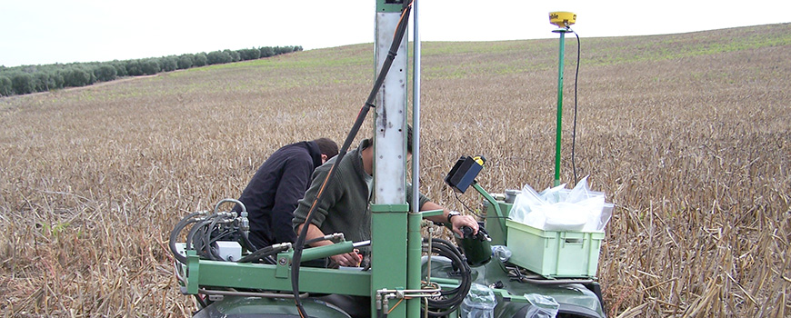
- Use of decision making systems base on the information collected by a network of sensors located in the farm, in the machinery, or in other items such as unmanned platforms “drones” and even satellites. All these sensors can generate a lot of knowledge about meteorology and characteristics of the farm: the variability of types of soil, harvest maps and the quality, nutritional status and water status of the crop, etc. With this information they can be produced maps of harvest, soil types, moisture, weeds, etc., which will serve as a basis for prescription maps for treatments, such as fertilization or herbicide applications, which are the most common.
- As an alternative to this system, they can be used real-time sensors that measure the desired parameters, perform the relevant calculations and act on the machinery without intervention of the driver. These systems are less accurate but faster and cheaper. They normally use sensors which rely on NIR technology and they measure, for example, the nutritional state of the crop and calculate the amount of fertilizer to apply based on its state. They can also be used to detect weeds in real time and perform site-specific treatments only where they are.
BENEFITS
- Better knowledge of the farmer of his own farm and better ability to make decisions.
- Optimization of the use of inputs.
- Better vegetative state of crops and therefore increased production.
- Increase the economic benefits of the farm.
- Reduction in the agriculture environmental footprint.
- Reducción de la huella ambiental de la agricultura.
